
The Development Division in the Office of Planning and Zoning leads the reviews of these applications, working as project managers who facilitate the development review process between review agencies and the applicant. This page contains helpful details for those considering a development project in Anne Arundel County.
How to determine what options are available to develop a property, or, what uses are allowed on the property.
Begin by identifying which zoning district the property is located in using the Zoning Map Viewer. An example of a zoning district is R5 - Residential District. If there is more than one zoning district overlaying a property, please contact Zoning Administration at 410-222-7437 for specific guidance.
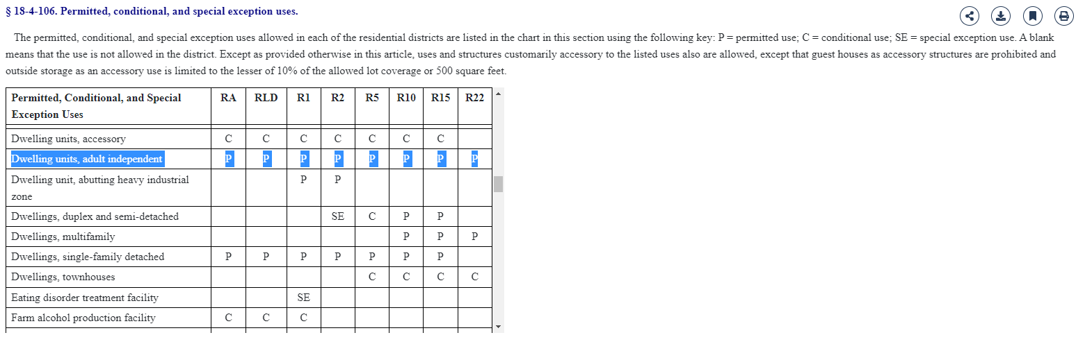
Once you have determined the zoning district in which the property is located, refer to Article 18 to view the permissible use charts by zoning district.
Additional information that applies to development of a site should then be reviewed under the appropriate bulk regulations within Article 18 for that zoning district. For instance, a developer of a property located within the R5 district would refer to Article 18-4-701 to see basic regulations to consider.
We recommend hiring a qualified professional to conduct a site feasibility study who is familiar with the development application process at Anne Arundel County if you would like to know the scope of the development potential of your property prior to the submittal of a development application. County staff are able to provide general information following the same process described herein.
How to determine when a property can be subdivided.
Determine the zoning district of the property on the Zoning Map Viewer.
Reference Article 18 in the Code for your specific zoning district to find the Bulk Regulations to determine if you have enough acreage or square footage to meet the Density requirements for your specific Zoning. Reference Article 17 of the Anne Arundel County Code to assess whether or not the proposed development can meet the property requirements.
It will be necessary to employ a licensed surveyor, engineer, or other qualified professional to prepare the plans, plats and other needed documents for review by the relevant County and State agencies, and the recordation of the plat and other documents in the land records of the County. It is advisable that an applicant meet with these consultants in order to determine the extent of the needed plans/studies/reports, as well as the cost associated with these types of applications.
Requirements for changing an existing use to a different use inside an existing facility.
Refer to our Article 17-4-101 of the Code to determine whether your request requires a Development Plan. For example, If your project will impact any of the Adequacy of Public Facilities found under our Code Article 17, Title 5, then a Preliminary Plan and Site Development Plan will be required.
Any development proposed will require a development plan, meaning the subdivision of property or any activity other than farming, gardening, or yard maintenance that results in a change in existing site conditions, including the establishment of a use; the change of a use; the improvement of property through construction, alteration, or relocation of a structure; the provision of stormwater management or roads; grading; and clearing.
Documents necessary to begin the Preliminary Plan application process include the Development Application, Preliminary Plan Checklist and Site Development Plan – Submittal Application Requirements and Site Development Plan checklist. Instructions are provided on each document. These three documents will be submitted along with the Preliminary Plan site plan and supporting documentation as needed based on the aforementioned checklists.
How to determine if a lot is buildable.
There are many factors that must be considered in determining the buildability of a lot. (It is important to note that the buildability of a lot may not be able to be assessed until a development application or building permit application has been made.) The lot must first meet the definition of a lot in Article 17-1-101(64) as per the Anne Arundel County Code. If the lot meets this definition, then it must be determined if the proposed development meets the bulk regulations in Article 18 for the zoning classification in which the lot is located. The zoning for a particular lot can be found on the County's Zoning Map Viewer.
If a single family dwelling/development is proposed on a single lot, outside of the Critical Area, then staff from Inspections and Permits 410-222-7730 will be able to answer any questions concerning this type of development.
If the lot is in the Critical Area, then please contact the Critical Area team at our site. If mixed-use, commercial or industrial (under Regional) development are proposed, contact the Regional team at our site and a staff person can answer questions concerning these types of developments on single lots.
Any questions concerning the zoning of a property, or the bulk regulations associated with the zoning, can be addressed to the Zoning Administration which is available at 410-222-7437 and on the Zoning Administration webpage.
The basics of the development application review process.
A development application review involves a comprehensive analysis of a proposed development and site configuration for compliance with the County Code. The application review will commonly include testing for Adequate Public Facilities (APF) to ensure that new growth or redevelopment can be supported by existing resources, or by those resources will be expanded concurrent with the proposal.
Additional elements that are considered include (but are not limited to) the potential impact to cultural or historic resources, environmentally sensitive features and forests, and public or private infrastructure. The application review process often requires resubmittals by the applicant in response to County feedback, which may require changes to the proposal or mitigation for necessary impacts. For additional information, refer to the Development Application Flowchart.
Types of development applications.
Development Application Flowchart
How to determine if a development application is required for a proposed development.
Begin by reviewing the Development Flowchart and applicable County Code provisions regarding development requirements.
Your project may require subdivision based on Article 17-3-201 and the definition of subdivision. Subdivision involves the process of dividing property into two or more parts. Applications are classified as either Subdivision or Minor Subdivision. Minor subdivisions are those that generally consist of five residential lots or fewer (including any existing developed lot). Subdivisions are generally those existing or proposed subdivisions that consist of more than five residential lots. Minor Subdivision applications are reviewed under a one-step process called Final Review. Subdivisions are reviewed under a two step process: Sketch Plan Review and Final Plan Review.
In specific instances an Amended Plat may be appropriate rather than a subdivision based on the Code provisions of Article 17-3-801. Alternatively, your project may require a Site Development Plan based on Article 17-4-101. If you need assistance in determining whether your specific development will need to complete the Site Development Plan review process, please use our Contact Us service available here.
What is involved in the development application review?
The standard review process includes a two-step approach prior to an application receiving approval to move to permitting.
For subdivisions, a development application will start with a Sketch Plan application review, per the requirements of Article 17-3-201. The Sketch Plan process is used to evaluate the feasibility of proposed development based on existing conditions and County Code requirements. Adequate Public Facilities (APF) may be tested and vested at this stage, but it is not required. Once the Sketch is approved, an application for the Final Plan will proceed for review of compliance with Article 17-3-301. The Final Plan will include testing for APF if it has not already occurred. Once the Final Plan subdivision is complete, an applicant may proceed to permitting.
For site development, the first step is the Preliminary Plan, which is similar to the Sketch Plan although no land is being subdivided. The Preliminary Plan requirements are stated in Article 17-4-201. Once the Preliminary Plan is approved, an application for the Site Development Plan will proceed for review of compliance with Article 17-4-202. The Site Development Plan will include testing for APF if it has not already occurred with the Preliminary Plan. Once the Site Development Plan is approved, the applicant may proceed to permitting.
Step 1)
Complete background research on your site, the application process and your proposed development. This includes understanding permitted uses per Article 18 and determining the appropriate type of development application, which will be completed through the Accela Land Use Navigator (LUN) website.
Tip: Read the Timeline/Flowchart prior to submitting an application.
Step 2a)
Review the requirements for the specific type of development application for which you are applying. This will familiarize you with the components that will be reviewed. The development application process is completed through the Accela Land Use Navigator (LUN) website. Completing an application through LUN will result in a record that contains the necessary information for your project to be reviewed. All applications are digital, as paper forms are no longer accepted as of August 4, 2025.
- Sketch Plan
- Preliminary Plan
- Final Plan
- Site Development Plan
- Amended Plat
- Redevelopment Concept Plan (to be created in the Development Resources webpage)
- Glen Burnie Concept Plan
As an example, a submission of a Preliminary Plan must include a Development Application, application fee, and all items detailed in the “Preliminary Plan – Submittal Application Requirements Checklist” (except for those determined not applicable to the proposed development in accordance with checklist instructions). The Preliminary Plan must be prepared in accordance with the “Sketch Plan – Preliminary Plan Checklist”, and include all information and attachments required therein.
Step 2b)
Determine if your application requires a community meeting to be held. Community meeting requirements can be found in Article 17-2-107 & 108 of the Anne Arundel County Code, with additional information and useful links found on the Office of Planning and Zoning’s Community Meeting webpage.
Note that if a community meeting is required for your project, it must be completed within the timeframe per Code prior to the initial submittal of your development application.
Step 3)
Hire a qualified professional. A development application requires the signature of a qualified professional to certify the accuracy of the information contained in the development application. It will be necessary to employ a licensed surveyor, engineer, or other qualified professional to prepare the plans, plats and other needed documents for review by the relevant County and State agencies and the recordation of the plat and other documents in the land records of the County.
Step 4)
All development applications and related documents must be submitted through the Accela Land Use Navigator (LUN) website.
Step 5)
Receive and review the County’s consolidated review letter that will be provided as a response to the development application. This letter will be provided via email in PDF format directly from the Accela Land Use Navigator website. You may also specifically request a hard copy to be mailed to you by responding to the email that includes your letter.
Tip: Ensure your application includes your email address.
Step 6)
Work with your hired professional to respond as quickly and accurately as possible to the feedback from the County in the review letter. The review letter will include a deadline date for response, for which you are required to resubmit updated materials through the Accela Land Use Navigator website, or the application will become void by the operation of law. Time extensions may be possible if requested prior to the resubmittal deadline.
Step 7)
Repeat steps 5 & 6 until you receive a decision on your project as either an approval or denial. The decision letter will be provided via email in PDF format directly from the Accela Land Use Navigator website. You may also specifically request a hard copy to be mailed to you by responding to the email that includes your letter.
Step 8)
If/when approval is received, proceed to the next step in the review process. Remember a typical development application process includes Sketch or Preliminary Plan, then Final or Site Development Plan, and then Permits.
Development Application Flowchart
Step 9)
Repeat steps 5-8 as necessary to reach the final step of Certificate of Occupancy or Certificate of Use.
Once a development application is approved, such as a Final Plan or Site Development Plan, an applicant may then proceed to the permit application stage. In some circumstances, a permit application is the first step when a project is exempt from the development approval process (please see details above on Understand the Review Process for Development Applications).
A project may require a grading permit prior to the building permit review. Some projects do not require a grading permit or may only need a Standard Grading Plan. The Permit Center will determine when a grading permit is or is not required.
Permits are applied for and managed by the Permit Center in the Department of Inspections and Permits. Additional information on requirements, how to apply, and checking the status of a permit application can be found on the Permit Center website.
All applications are processed through the Accela Land Use Navigator website. A team of intake staff will provide an initial review for completeness. The applications are distributed to the Office of Planning and Zoning, Development Division where they are assigned to one of three planning teams: Residential, Critical Area or Regional (Commercial and Mixed Use). The Transportation team will review all projects for compliance of transportation related regulations but are not the project managers.
As a general rule, development applications are assigned to an OPZ Lead Planner in the following ways - If your project is located within the Critical Area or a Bog, your application will be reviewed by the Critical Area team, regardless of the proposed use.
If your project is located within a Town Center (such as Parole or Odenton), or within Commercial, Industrial, or Mixed-Use (MXD) Zoning Districts, then your application will be reviewed by the Regional team.
Lastly, if your project is a proposed residential use, Cell Tower, Assisted Living, School, or Church outside of the Critical Area or a Commercial, Industrial, Mixed-Use or Town Center Zoning district, then it will be reviewed by the Residential team.
Once your project is assigned an OPZ Lead Planner and team, all applicable County and State agencies will review your project for compliance with the County Code, as well as State regulations when necessary.
Article 17 is administered and interpreted by the Planning and Zoning Officer and the Office of Planning and Zoning, except that the expedited review program established under § 17-2-111 may also be administered by the Director of Inspections and Permits and the Department of Inspections and Permits. Therefore development applications are subject to the approval of the Planning and Zoning Office. The applicant is not required to present the proposed development application to a specific Commission or at a Public Hearing (the exception may be for development related requests, such as a Variance request). Notably, an applicant may need to hold a community meeting for informational purposes. Details on community meetings can be found on the Community Meeting landing page or in the information provided in this page’s “Determine Property Development Potential” section.
Tips and Resources for Development Applications
No, County staff cannot recommend a specific person or firm to perform the work. However, we can recommend a few methods to find a reputable qualified professional, as noted below:
1) Try a basic Google search. Common search terms include subdivision or site plan engineer, architect or consultant. Be sure to include Anne Arundel County or the area your property is located in to help identify those who have local experience. A local professional is not required, but you may want to find someone who has knowledge working in Anne Arundel County previously on development applications.
2) Ask your neighbors, HOA or use an online forum such as Facebook Groups or NextDoor. Their real-world experience may prove very helpful, and you may be able to see similar examples of the work you want done.
3) Check out the Community Meetings portion of our website. There you can watch meetings held by professionals on past projects. You may find a professional you are interested in working with due to their presentation or if they are working on a project similar to yours.
The Office of Planning and Zoning will provide a consolidated response letter each time a development application is submitted or a revision is resubmitted for a project. In response, an applicant should update the site plan to reflect the comments provided by the County to revise the application for compliance with the County Code. It may be necessary to supply additional documentation, do on site research, or change the proposed layout of the site plan. If questions arise, contact the reviewer who supplied the comments. Their name is provided at the top of the comment memorandum that is attached to the consolidated letter, and their contact email can be found on our organizational chart or the memorandum itself.
The applicant will have a specific amount of time to respond and resubmit the development application, with the deadline specified in the consolidated letter. Applications cannot be submitted after the deadline, otherwise they are considered void by operation of law. The more comprehensively and accurately an applicant can respond to a comment, the more efficient an application can be reviewed. We recommend that resubmittals are double-checked for cohesion and completeness prior to submitting. Please remember to include an explanation letter in response to County comments, being as thorough as possible in providing feedback and necessary documentation to enable an effective review by the County.
Yes, a time extension may be requested as a modification or an administrative decision, depending on the type of development application. All time extensions must be submitted prior to the resubmittal due date, with administrative time extensions having a specific minimum number of days before the resubmittal due date that they must be requested, per the County Code. The specifics on time extension requests for subdivisions are found in Article 17-3-203 for sketch plans and Article 17-3-303. Information on site development plan time extensions can be found in Article 17-4-203.
Note that the documents are grouped by topic.
Resources
Generally, development review involves Articles 16, 17 and 18.
Please contact our Office with specific questions here.
Critical Area-Specific Information
The Chesapeake Bay Critical Area extends a minimum of 1,000 feet landward of tidal waters and tidal wetlands of the Bay and its tributaries.
State and local Critical Area legislation has been enacted for the protection of the Bay and its tributaries. These laws regulate all construction activities within the Critical Area, including projects involving ground disturbance; removal and/or cutting of existing natural vegetation and installation of new or expanded impervious surfaces (asphalt, concrete, paving blocks and stone used for driveways, sidewalks, parking pads and the like).
Except for routine grass cutting and maintenance of existing garden and landscaped areas, removal of any existing natural vegetation within the Critical Area buffer or protected forests or woodland is subject to prior approval through the Code Compliance Division. Call (410) 222-7441 for information on obtaining a standard Vegetation Management Plan or Forest Management Plan.
In Anne Arundel County, to find out if your property is located within the Critical Area go to the following link, call (410) 222-7960 or send an email to CriticalAreaTeam@aacounty.org with your street address or tax account number and your property’s location relative to the Critical Area will be checked for you.
Critical Area-related information to be provided with the permit application includes the following:
- Total site area and area of the site within the Critical Area,
- Critical Area land use designation and corresponding limits within the site,
- Limits of the proposed disturbed area,
- Limits of various surfaces for both the existing and proposed conditions (i.e., pavement, structures, gravel, vegetation, and other impervious and previous surfaces),
- Limits of all sensitive areas (reference the Sensitive Area dropdown on this page),
- All calculations (reference the Tabulations dropdown on this page)
- Any agreements or forms, such as the following (reference the Forms and Agreements dropdown on this page)
- Forestation Agreement
- Forest Conservation Easement
- Natural Conservation Easement for Septic Reserve
- Impervious Surface Removal Affidavit
- Garage Affidavit
- Floodplain Acknowledgement
- Lot Merger Agreement
- Critical Area Worksheet (for Building Permits)
The Interactive Resources tab on the Critical Area webpage (see Critical Area link on the left side of this page) may be helpful with information related to the Critical Area and the sensitive areas.
Any of the following sensitive areas that exist on a site should be identified on the permit application drawings and protected in accordance with the County and State regulations. County Critical Area regulations include Articles 17-8 and 18-13; state regulations are within COMAR Title 27.
- Steep Slopes (15% slope or greater that is over six vertical feet) and the 25-foot slope buffer
- 100-foot Buffer
- Non-Exempt Buffer (requires a variance, reference COMAR 27.01.09),
- Buffer Modification Area (BMA, reference County Code 17-8-7), and
- Expanded Buffer (reference County Code 18-13-104)
- Wetlands (tidal and non-tidal) and corresponding wetlands buffer
- 100-foot tidal wetlands buffer
- 25-foot non-tidal wetlands buffer
- Floodplain
- Streams and 100-foot stream buffer
- Bog and type of protected bog area
- Bog Area
- Bog Protected Stream
- 100-foot Bog Buffer (Upland Buffer)
- 300-foot Bog Buffer (Limited Activity Area)
- Bog Contributing Drainage Area
- Protected Habitat Areas
- Existing Forest Conservation Easements
- The Interactive Resources tab on the Critical Area webpage (see Critical Area link on the left side of this page) may be helpful with information related to the sensitive areas.
Calculations that may be required for development within the Critical Area include the following:
- Lot Coverage (LC)
- Existing LC, including the quantity for each contributing area and the limits,
- Maximum allowable LC (County Code 17-8-402),
- Proposed LC, including the quantity for each contributing area and the limits, and
- Proposed removal of existing LC, if applicable (i.e., reconfiguration of LC per County Code 17-8-403)
- Forest/Woodland (F/W)
- Existing F/W, including area of canopy, percentage of total lot size, and limits of the canopy,
- Maximum allowable clearing of F/W (County Code 17-8-601),
- Proposed clearing F/W, including area of canopy, percentage of existing F/W, and limits of the canopy to be removed, and
- Reforestation/Afforestation required and proposed (if applicable for stormwater, clearing, BMA/buffer disturbance, or otherwise)
- Planting Plan
- Location of plantings
- Species of plantings (should be native to Anne Arundel County)
- Number of plantings
- Size of plantings
Per Code 17-6-102, vegetation shall be used as a shore erosion control measure unless it is demonstrated to be ineffective. In that event, an alternative measure shall be used in the following order of preference:
- vegetation in combination with a stone sill, groin, breakwater, or similar wave dissipating structure;
- the establishment or expansion of a beach by placing sand fill between the mean high-water line and mean low-water line;
- riprap and materials similar to riprap that are composed of loose, permeable components; or
- a bulkhead, groin, jetty, revetment, or seawall if the erosion rate is greater than two feet per year or when site constraints, such as water depth or topography, make other measures impractical.
Living shoreline reference materials may be found in this website at the following location.
Forms and Agreements for development in a Critical Area and/or Bog can be found at the following link.

Location and Hours
Address
Heritage Complex, Building 2664
2664 Riva Road, Annapolis, MD 21401
Hours
Open: Mon - Fri, 8am-4:30pm
Customer Support: Mon - Fri, 8am - 3:45pm, or by appointment
Telephone Numbers
Residential (410) 222-7458
Regional (410) 222-7485
Critical Area (410) 222-7960
Transportation (410) 222-7462