Project Purpose
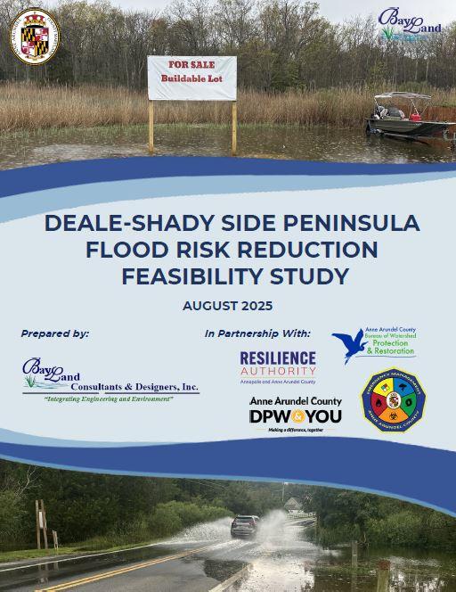
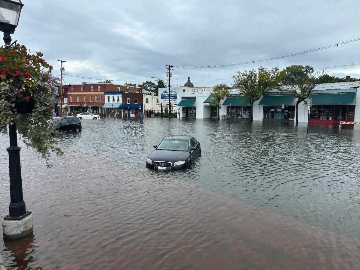
The Deale-Shady Side Peninsula Flood Risk Reduction Feasibility Study, published September 8th, 2025, determines cost-effective, feasible mitigation strategies that enhance resilience of the Peninsula in the face of increasing flood inundation levels and storm event intensities/frequencies associated with a changing climate. The primary deliverable includes a comprehensive adaptation report that includes a menu of preferred, cost-effective, and feasible mitigation projects that will reduce risks to people and properties within the benefitting area. Preferred projects were determined based on vulnerability to the threats of compound flooding. Various desktop analyses, storm water and coastal modeling, and input from the community on climate related concerns were all used to prioritize areas for mitigation strategy implementation.
Project Documents
Access the final report and appendices below:
- Report - Deale-Shady Side Peninsula Flood Risk Reduction Study
- Appendices - Deale-Shady Side Peninsula Flood Risk Reduction Study
On July 22nd, 2025, the Bureau of Watershed Protection & Restoration, Office of Emergency Management, Office of Planning & Zoning, Resilience Authority of Annapolis and Anne Arundel County, and BayLand Consultants & Designers hosted a Public Meeting previewing the upcoming report for the Deale-Shady Side Flood Risk Reduction Study. View the slides here!
Frequently Asked Questions
This report shows how at-risk different parts of the Deale–Shady Side Peninsula are to flooding. It explains what’s making it worse, like sea level rise, erosion, and poor drainage, and outlines ideas to make things better. It’s meant to help residents and community leaders understand what’s happening and plan ahead. If you’ve noticed more flooding over the years or are worried about your home, roads, or neighborhood, this report offers useful tools to think through next steps.
Each community has a “flood report card” that summarizes how vulnerable it is, what kinds of flooding are happening (like tidal or stormwater), and what issues need the most attention. This helps residents and the County prioritize which areas need action first. You can use your community’s report card to talk with neighbors, HOAs, or local officials about changes you want to see.
The project concepts are different ways to reduce flooding, like raising roads, improving drainage, or adding natural buffers. Each concept lists what community it helps, how much it might cost, and how hard it would be to build. These are not final plans, but examples of what could be done. You can use them to start conversations with your community or to ask the County for support. You can find them in Table 29 of the report.
This report is a tool. The County, Resilience Authority, and local partners are using it to guide future planning. But, community action matters, too. If your neighborhood wants to move forward on a project, this report helps make the case. Residents can also take steps on their own, like improving stormwater on private property or joining workshops to learn more.
The report discusses various funding mechanisms in the context of the Case Studies, but makes no funding obligations for any specific project. Many future projects will rely on partnerships between the County, the Resilience Authority, local nonprofits, and community members like you. There are lots of potential funding sources, including grants, small community mini-grants, low-interest loans, and even tax credits. Many of these opportunities, particularly the grants, will require teaming up with a nonprofit or government agency, and many also need neighbors to pitch in together.
Property value evaluation and modeling was not in the scope of this report. This report is not to be used to inform any property value assessment. The vulnerability analysis conducted was solely to inform and prioritize mitigation strategies, based on the best available models.
This is specific to the community and the issue at hand. The Project Concept sheets do have a qualitative urgency metric which is located near the bottom right corner of each card. Projects need to be ranked, designed, funded, and permitted before anything is built. Some concepts in the report have higher urgency, but even those take time. In the meantime, communities can plan together, explore funding options, and begin smaller, lower-cost projects if possible.
Start by reviewing your neighborhood’s flood report card and the project ideas in the report. This will give you a sense of the risks in your area and what kinds of solutions might work. From there:
- Talk with neighbors, your HOA, or local groups about shared concerns and possible next steps.
Connect with the Watershed Stewards Academy (WSA) to request a site assessment or learn about ways to reduce flooding on your property. - Reach out to Anne Arundel County or the Resilience Authority if you’re interested in moving a project forward. You may need to partner with a nonprofit or community association to apply for funding.
- Consider small, DIY solutions if larger projects feel out of reach, like planting rain gardens, directing runoff away from your foundation, or attending local workshops.
No matter where you start, you’ll likely need to team up with neighbors, a nonprofit, or local government to move a community-scale project forward.
- For residential or small community projects, reach out to a local nonprofit like the Anne Arundel Watershed Stewards Academy. They can help guide you and may offer resources or technical support.
- For larger projects or anything involving County infrastructure, contact either the Anne Arundel County Department of Public Works Bureau of Watershed Protection & Restoration at bwprcustomercase@aacounty.org or 410-222-4240 or the Resilience Authority of Annapolis and Anne Arundel County at resilienceauthority@acounty.org.
The Watershed Stewards Academy offers free online resources to help you manage stormwater on your property. You can also schedule a free Residential Site Assessment with a trained Watershed Steward. Plus, you may qualify for two tax credits if you install and maintain stormwater solutions like rain barrels, rain gardens, or living shorelines (Stormwater Management Property Tax Credit and the Watershed Protection & Restoration Fee Credit).
If your community only has one way in and out, or you’ve seen roads flood during storms, planning ahead is critical. Start by talking with your neighbors and HOA. You can also contact the Anne Arundel County Office of Emergency Management at oemoutreach@aacounty.org or 410-222-0600 for guidance.
The study focused on higher-population areas, but that doesn’t mean smaller neighborhoods aren’t at risk. If you live next to a high-risk area, your community may also be impacted by flooding and sea level rise. You can still use the report to plan, organize, and prepare, even if your specific neighborhood wasn’t highlighted.
If your well or septic system is in a low-lying or frequently flooded area, it could be impacted by rising groundwater or stormwater. The report doesn’t assess individual systems, but if you’re concerned, contact the Anne Arundel County Health Department to learn more about inspections, risks, and mitigation.
Yes — while many of the long-term solutions focus on property owners, renters are part of the community too. Your voice matters. Renters can attend meetings, join local groups, advocate for safer housing, and help raise awareness with landlords or neighbors.
You’re not alone. Many residents face financial barriers. The County and nonprofits are working to expand funding and technical assistance. Some programs offer cost-sharing, grants, or workshops to support smaller fixes. Partnering with neighbors to apply for community-scale funding can also reduce costs per household.
Questions about the Report?
For questions or comments relating to this project, please contact either the Anne Arundel County Department of Public Works at pwcust00@aacounty.org or 410-222-7500 or the Resilience Authority of Annapolis and Anne Arundel County at resilienceauthority@aacounty.org.
Surveys and Flood Reporting
-
 Share your comments here!
Please use this form to share your comments, questions, or concerns about the Deale-Shady Side Peninsula Flood Risk Reduction Feasibility Study. Your input will help guide future planning efforts and ensure the study reflects local priorities and experiences.
-
 Hazard Mitigation Plan Update Survey
Anne Arundel County is currently in the process of updating its 2018 Hazard Mitigation Plan. The Anne Arundel County Office of Emergency Management (OEM) is the lead agency for this planning process. Therefore, OEM is seeking input on stakeholder's concerns regarding hazards identified in the plan. This survey is being used to collect your insight and perspective on hazards identified in the plan.
-
 MyCoast: Maryland
Help us document flooding and storm damager using MyCoast. High tide flooding, precipitation-caused flood impacts, or coastal storm damage should also be reported on the Maryland MyCoast website of the free MyCoast Smartphone App.
The Deale-Shady Side Peninsula
The Deale-Shady Side Peninsula is the southeastern portion of the county along the Chesapeake Bay. The area includes all of Shady Side and Churchton along with parts of West River and Deale.
Project Background
The Shady Side Peninsula is the southeastern portion of the county along the Chesapeake Bay. The area includes all of Shady Side and Churchton along with parts of West River and Deale.
The proposed area of interest is an approximately 13 square mile peninsula was specifically called out as a high-risk area for flooding in the County’s 2018 Hazard Mitigation Plan. The mean elevation within the benefitting area is 7.68 feet above sea level and is fragmented by creeks and wetlands. The primary risk to residents and businesses within the benefitting area is life safety and property damages resulting from acute flooding. However, over time, floodwaters are expected to persist longer and threaten transportation between communities and essential community lifeline services.
On May 3, 2021, the Anne Arundel County Council adopted a set of climate change and sea level rise policies in the latest update of the County-wide General Development Plan, Plan2040. This project supports those efforts to incorporate considerations of vulnerability to sea level rise, coastal flooding, and nuisance flooding into community development plans. Concepts from various state and county sea level rise and mitigation plans will be integrated into the plan update for a consistent, data- driven approach to reduce sea level rise impacts to property, infrastructure, and cultural resources.
In 2023, Anne Arundel County conducted a study of risks related to sea level rise based on the latest projections from federal and State agencies and university researchers. The study assessed risks across the entire County and included a more detailed analysis of the Deale-Shady Side Peninsula. Please see the Office of Planning & Zoning's Sea Level Rise webpage for an overview of the findings of risk assessment and the full report.