Project Purpose
The Sea Level Rise on the Deale-Shady Side Peninsula Feasibility Study will determine cost-effective, feasible mitigation strategies that enhance resilience of the Peninsula in the face of increasing flood inundation levels and storm event intensities/frequencies associated with a changing climate. The primary deliverable will include a comprehensive adaptation report that will include a menu of preferred, cost-effective, and feasible mitigation projects that will reduce risks to people and properties within the benefitting area.
Preferred projects will be determined based on vulnerability to the threats of compound flooding. Various desktop analyses, storm water and coastal modeling, and input from the community on climate related concerns will all be used to prioritize areas for mitigation strategy implementation.
-
 Community Input Survey (Google Form)
What form(s) of flooding are you most concerned about? What areas of the Deale-Shady Side Peninsula are you most concerned with? What would you like to see happen? Help us make the Peninsula more resilient by completing a brief Community Input Survey!
The survey is available both virtually (click here!) and in print (click the red button below to open a PDF version). -
 MyCoast: Maryland
Help us document flooding and storm damage using MyCoast High tide flooding, precipitation-caused flood impacts, or coastal storm damage should also be reported on the Maryland MyCoast Website or the free MyCoast Smartphone App.
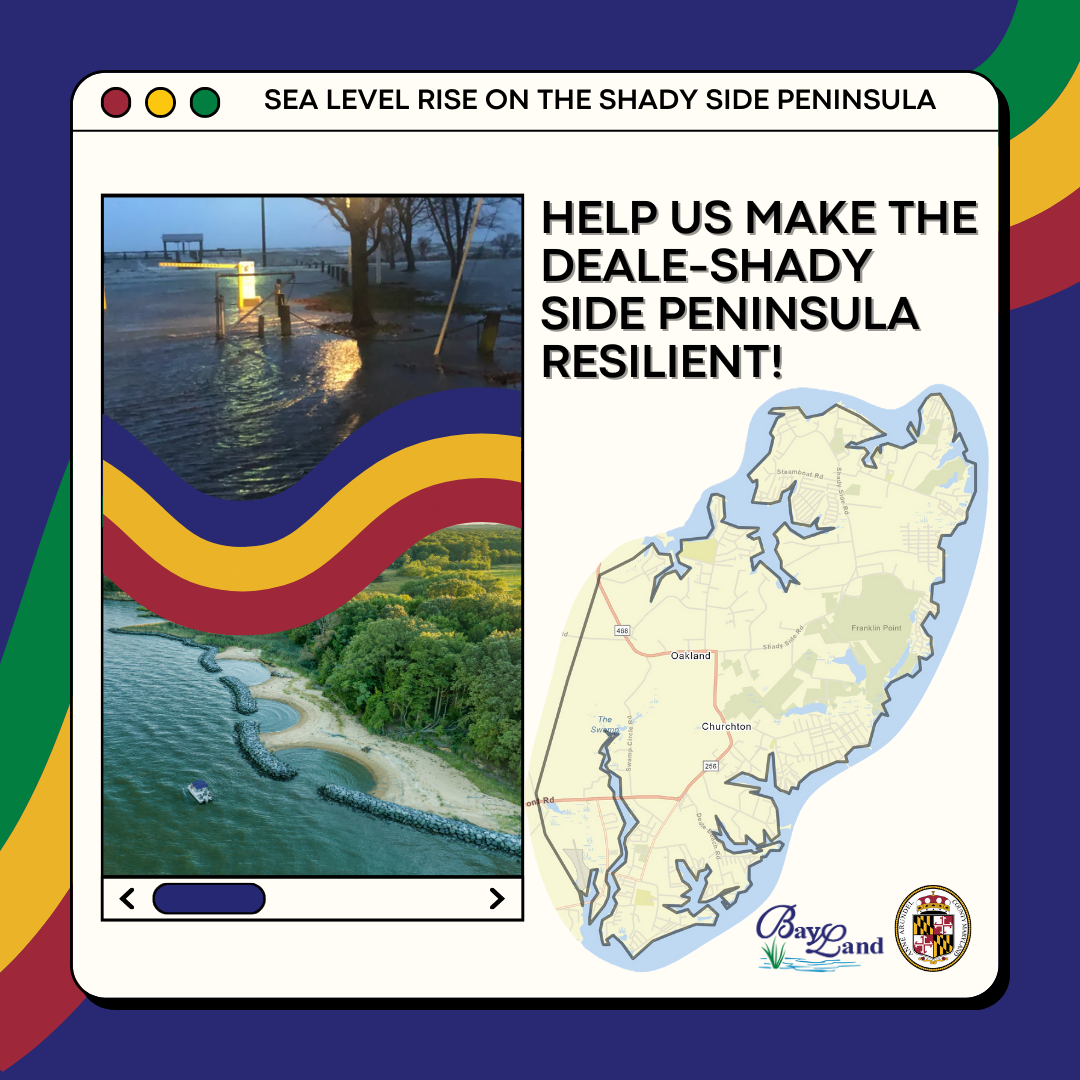
The Deale-Shady Side Peninsula
The Deale-Shady Side Peninsula is the southeastern portion of the county along the Chesapeake Bay. The area includes all of Shady Side and Churchton along with parts of West River and Deale.
Project Background
The Shady Side Peninsula is the southeastern portion of the county along the Chesapeake Bay. The area includes all of Shady Side and Churchton along with parts of West River and Deale.
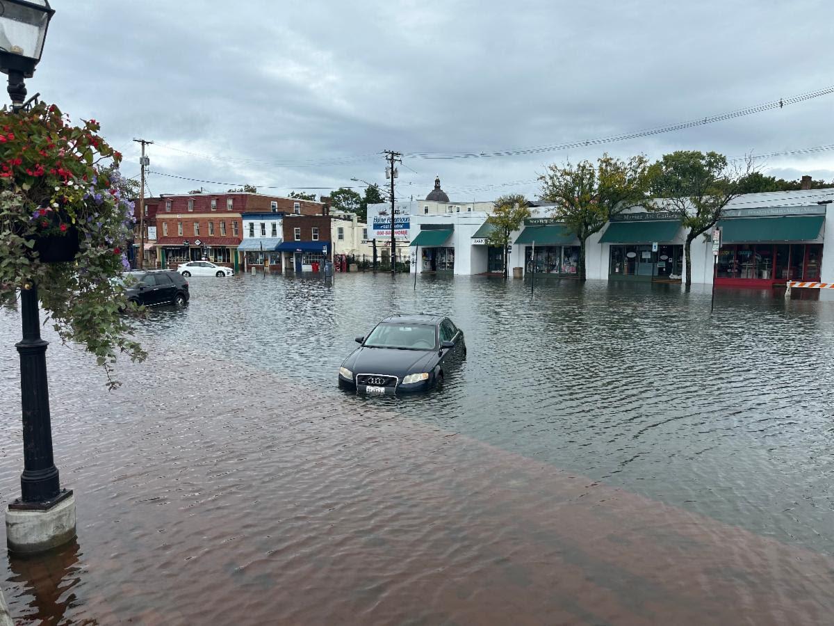
In 2023, Anne Arundel County conducted a study of risks related to sea level rise based on the latest projections from federal and State agencies and university researchers. The study assessed risks across the entire County and included a more detailed analysis of the Deale-Shady Side Peninsula. Please see the Office of Planning & Zoning's Sea Level Rise webpage for an overview of the findings of risk assessment and the full report.
The proposed area of interest is an approximately 13 square mile peninsula was specifically called out as a high-risk area for flooding in the County’s 2018 Hazard Mitigation Plan. The mean elevation within the benefitting area is 7.68 feet above sea level and is fragmented by creeks and wetlands. The primary risk to residents and businesses within the benefitting area is life safety and property damages resulting from acute flooding. However, over time, floodwaters are expected to persist longer and threaten transportation between communities and essential community lifeline services.
On May 3, 2021, the Anne Arundel County Council adopted a set of climate change and sea level rise policies in the latest update of the County-wide General Development Plan, Plan2040. This project supports those efforts to incorporate considerations of vulnerability to sea level rise, coastal flooding, and nuisance flooding into community development plans. Concepts from various state and county sea level rise and mitigation plans will be integrated into the plan update for a consistent, data- driven approach to reduce sea level rise impacts to property, infrastructure, and cultural resources.
Stay Involved
details coming soon!
Upcoming Activities
details coming soon!
Past Activities
details coming soon!